
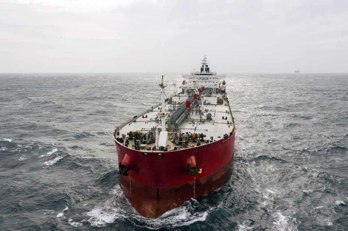
In the Strait of Hormuz, physical damage to ships is often the easy part to verify; what’s hard—and strategically decisive—is pinning down the mechanism and the rules of the waterway in a contested security environment where mines, limpet mines, and “unauthorized routes” have become tools of narrative as much as of warfare.
At a Glance
- Iran’s Revolutionary Guard Corps (IRGC) claims multiple ships struck naval mines while transiting a “southern” path it calls unauthorized; it has not publicly named the vessels.
- Maritime incident reporting confirms casualties in the area—but classifies some as projectile or limpet-mine attacks, not contact mines.
- U.S. Central Command says internationally recognized primary routes are clear of sea mines, highlighting a split-screen reality for shipmasters.
- The pattern mirrors past Gulf crises: real damage, competing attributions, and legal ambiguity over routing and control.
What is actually established—and what is not
Across the reported window, credible maritime channels did record serious incidents near the Strait of Hormuz: a tanker hit by an unidentified projectile and a separate vessel that caught fire and later sank near Khasab—evidence that something violent and consequential happened in this traffic-choked chokepoint. These are independent from Iran’s multi-vessel mine narrative, which, as of the reporting period, remained unverified and largely unsupported by hull names, IMO numbers, or inspection records that would let investigators triangulate causes across specific ships. A separate case—Singapore’s authority confirming the loss of GFS Pride after fire and damage—demonstrates a major casualty near the disputed area, but without forensic attribution to a mine.
Iran’s account is unusually specific on mechanism (naval mines), routing (an “unauthorized” southern track), and alleged violations (warnings ignored, radars off). Specificity is helpful because it creates claims that could, in principle, be falsified or confirmed against tracks, VHF/NAVTEX logs, and hull forensics. Yet in the open record surveyed here, the necessary verifiers—vessel identities, blast-pattern analysis, residue tests—are not public. Meanwhile, the United Kingdom Maritime Trade Operations (UKMTO) logged at least one tanker strike by an “unknown projectile,” not a mine, and reported a separate small-boat attack attaching limpet devices to a hull—tactics conceptually distinct from drifting or moored contact mines.
How mine claims fit—and clash—with the other incident types
Mines come in flavors. Contact mines require the hull to touch them; influence mines detonate on magnetic, acoustic, or pressure signatures; limpet mines are hand-placed by divers or small craft. Iran’s statement points to vessels “striking” mines along a misrouted southern corridor. If true, damage signatures would bias toward contact or influence mines along predictable ship tracks. By contrast, UKMTO’s reporting of a small craft attaching two explosive devices fits the limpet profile—close, deliberate placement below the waterline, often below the turn of the bilge to maximize flooding and complicate at-sea repair. Those are different mechanisms with different intelligence trails. Lumping them together under “mine activity” blurs the operational picture and—crucially for insurers—affects risk models and premiums.
The counter-assertion from U.S. Central Command that primary traffic separation schemes are mine-free complicates matters further. If the internationally recognized lanes are clear, then the hazard—whatever its precise mechanism—clusters outside them, or attackers are using methods other than traditional sea mines. That conclusion aligns with the mixed reporting of projectiles and limpet-style attacks and with the absence of public proof of broad minefields in the primary corridors.
The identification gap: why named ships, times, and coordinates matter
When investigators can’t match claims to specific hulls, the analysis stalls. Without names, flags, and IMO numbers, you cannot pull classification-society surveys, flag-state casualty files, or insurer loss notes; without coordinates and timestamps, you cannot reconcile AIS tracks against alleged “unauthorized” corridors; without damage photos and metallurgical reads, you cannot distinguish a below-waterline blast bulb from an engine-room fire that migrated aft. The present record suffers from precisely these absences. Iranian statements assert warning violations and transponder silence; independent channels confirm incidents but point to different mechanisms for at least some of them; neither stack yet yields the kind of forensic chain that would settle causation across the alleged set of five.
This is not novel for Hormuz. In 2019, investigators concluded with high confidence that limpet mines were used in several Gulf of Oman attacks, but public attribution to a perpetrator remained politically freighted even as the technical diagnosis solidified. Today’s picture echoes that structure: mechanism-level clues are emerging, but the umbrella narrative—“five ships hit mines on a southern route”—is not corroborated at the vessel-by-vessel level.
Who controls the routes? The law and the politics aboard the bridge
The heart of the dispute is not only how ships were damaged but who gets to dictate where and how they transit. Iran describes a “southern” corridor as unauthorized and claims it issued warnings that were ignored. Master mariners navigate by a web of coastal-state regulations, international strait regimes, and practical security advisories from UKMTO and industry. If a coastal state purports to close a channel or impose permissions beyond what the transit-passage regime contemplates, shipowners lean heavily on widely recognized schemes and coalition escorts; insurers price the delta between paper law and practical hazard. CENTCOM’s statement that recognized primary routes are clear of mines is, in effect, a signal to keep to those lanes—and a rebuttal to claims of broad Iranian control over routing.
For operators, the distinction is operational, not academic. Insurers care whether a casualty occurred inside or outside promulgated lanes, whether guidance was heeded, and whether a minefield existed or an attack was bespoke. A limpet strike by a small boat near a port approaches a different clause of a war risk policy than a drifting mine along a loaded egress, and both differ materially from a missile or onboard fire. The market’s muscle memory from the 1980s Tanker War and the 2019 Gulf incidents is to price the mechanism, the geography, and the predictability of risk—not the rhetoric around them.
What would settle the argument
Three data bundles would convert contested claims into testable history. First, a vessel-by-vessel docket: names, flags, IMO numbers, time of impact, precise coordinates, and routing plans matched to AIS/LRIT histories. Second, hull and wreck forensics: underwater imagery, blast-pattern analysis, residue assays, and classification-society surveys capable of differentiating contact/influence mines from limpet placements or internal casualties. Third, the communications trail: NAVTEX and VHF logs, coastal warnings, and bridge recordings to verify whether warnings were transmitted, received, and legally binding for the waters in question. Absent these, the best the open record can do is aggregate incident types—projectile, limpet, fire and sinking—and show that the IRGC’s multi-vessel mine explanation remains unverified and, in parts, inconsistent with independent incident classifications.
Until that evidence is public, prudent operators will assume a composite threat picture: keep to recognized lanes; treat close-approach small craft and suspicious hull contacts as distinct hazards; harden bridge and watch procedures; and maintain redundant tracking and comms through UKMTO and coalition channels. That posture aligns with both the CENTCOM assurance on primary routes and the UKMTO record of varied attack modes.
IRAN WATCH | HORMUZ
Nov. 5UKMTO reports 5+ vessel incidents since Nov. 1. Iran claims more mine strikes, still unverified.
This is bigger than one tanker. It's about who controls passage through the strait. Watching attribution and changes in the U.S. response.
Sources:…
— Kyle Shelton🌵🇺🇲🤠 (@driftsignalTX) November 6, 2026
The durable takeaway for mariners and markets
The Strait of Hormuz will continue to produce days in which several things are true at once: ships are damaged; different actors claim different mechanisms; and the legal fight over who “authorizes” a route runs parallel to the physical fight over who can threaten it. The responsible reading of the current evidence is straightforward: multiple, serious incidents occurred; some were not mines; and Iran’s claim that five ships struck mines on an unauthorized southern route has not been independently verified and is not reconcilable, on the public record, with specific, named casualties. Planning and pricing should proceed accordingly—by mechanism, lane, and proximity risk—rather than by headline.
Sources:
zerohedge.com, argusmedia.com, nationalsecurityjournal.org, rnamedia.in, gcaptain.com, gulfnews.com